Friday, April 19, 2019

Continental Divide ride 2018 - Part 10

Part 9

Leaving Buena Vista, Colorado, our intended route was to head up to Cottonwood Pass where we'd regain the Colorado BDR on the crest of the Divide and follow it south. But we discovered the road was closed throughout 2018 to allow for a major renovation of the pavement. Too bad, because one of my personal goals for the trip was to soak in the Cottonwood hot springs near the start of the ascent, which I'd last visited with a friend on a mountain biking trip back in 2007:
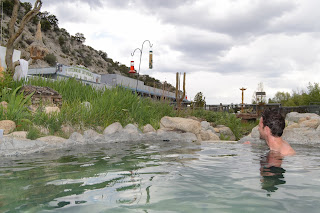

However, the other guys weren't keen on the hot springs, and since we had to find another route, it was out of our way. While I was a little bummed by this, there was still lots to discover and the hardest parts of our trip (with all their uncertainties and how they'd affect our schedule) still lay before us. Tincup Pass just to the south looked like a convenient alternative route back to the BDR, although we'd heard it was one of the more technical options and could be a significant challenge on loaded ADV bikes. Despite some trepidation from the other guys (see, that's where pre-relaxation in a hot spring can help!), we were all pretty excited to give it a shot.

The approach to Tincup up Chalk Creek gulch passed by Mt. Princeton and the aptly named Silver Cliffs, which were brilliantly illuminated by morning sun.


Eventually we reached the historic mining town of St. Elmo.


While there didn't seem to be much open to visitors when we passed through, the town now serves as a major jumping-off point for OHV tours and was buzzing with squadrons of Jeeps, side-by-sides, and the occasional dirt bike arriving and lining up for departure. We were the only ADV riders in sight. Had there been no crowd, we might've looked around a bit. Instead, we decided to head straight for the top to avoid worsening congestion.

Since the road over the pass is designated a county road, you don't need an OHV permit to travel it so as long as you stay on the main track. But don't be fooled by the county road status: this pass proved to be one of the most technical sections of the whole trip. Jeff had already worked up some serious anxiety after watching a number of Jeep videos the night before, whereas Pete was his usual cheerful British understated self, Buddha-like in his philosophical reaction to danger.

It was indeed hard work, and I wasn't able to grab photos of the ascent since there was no good opportunity to stop. Be assured the track was narrow, steep, lined with dense bush, covered in loose softball- and head-sized boulders, washed-out, rutted, and overrun with OHV traffic that couldn't travel very fast and raised choking dust. Couple with the elevation gain, both my and my bike's engine struggled to breathe and stay cool.

Maintaining forward momentum was key to staying upright, so a lot of my riding was in gears 1-3 to handle the grade and not stall out. Too slow, and the suspension would just follow the bumps instead of compressing, causing you to get stuck. Too fast, and you'd jackhammer the obstacles too hard, get air, and lose control. You had to trust that your bike would work and use the gas. The magic speed for me was about 2-3 times as fast as the OHVs, so I was able to fly past them on the few occasions where there was room, and when we could see each other through the clouds of dust. There were few places to stop in the forest on the way up, so each of us picked our own way on our own time, using our helmet comms to call out obstacles and strategies and novel curses.

Had the trail been wet or muddy, it might very well have been too hard for us to ride with our loads. There was lots of evidence of prior mud and deep puddles, but amazingly it was mostly dry for us and therefore reasonably grippy.


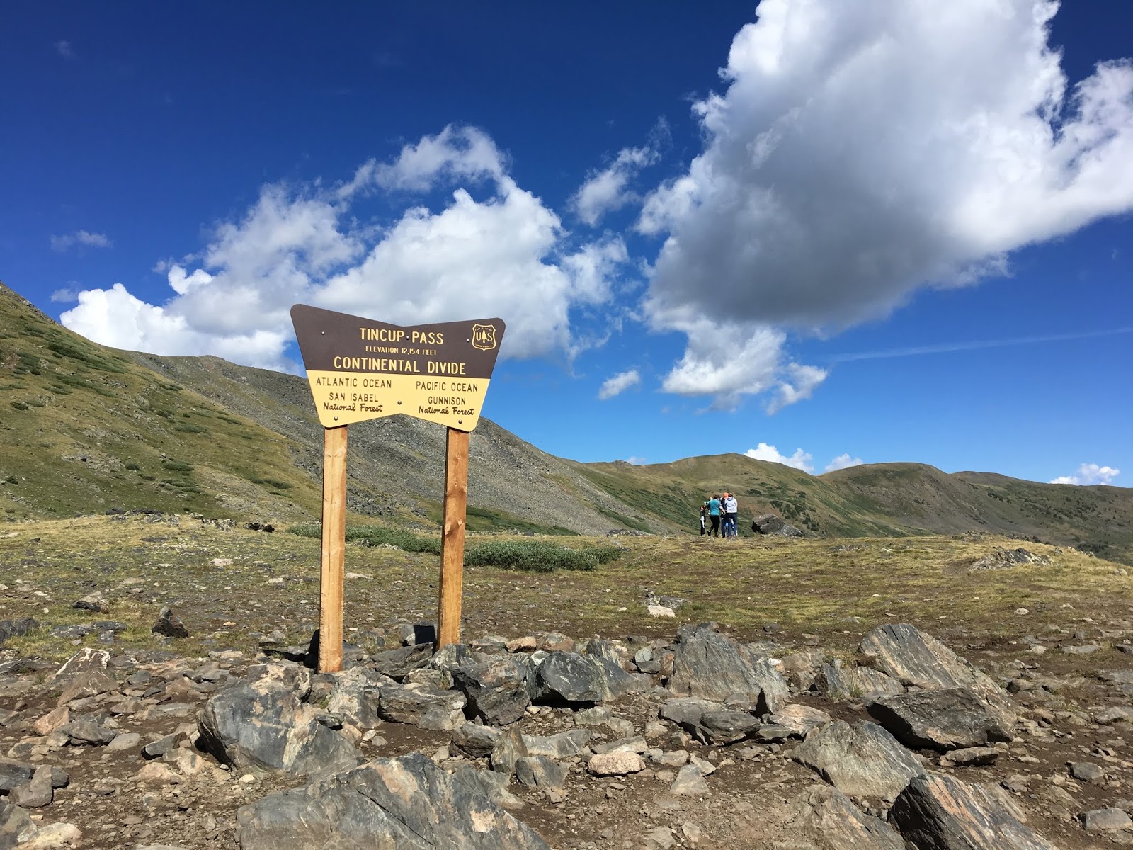
We arrived at the pass (12,154') all sweaty and pumped out, glad to have the traffic jams behind us.

The descent proved harder: first, a greasy series of rock steps among loose stones. I went first to recon a line, and then together we coaxed and spotted each other through, each taking different lines with a couple of dropped bikes along the way. It would've been significantly easier without our loads, which added unwanted inertia to delicate maneuvers and sapped throttle response--especially at the high elevation. 


The steps were followed by a white-knuckle ski-ride down a relentless grade with a ball-bearing surface. Braking was all but useless with our loaded bikes, so again we had to find a speed that was fast enough to let the suspension do its thing, but not so fast that you'd run away and hit something too hard--which included significant traffic coming uphill towards us. It took all our concentration to ride, because often the best line was blocked by an oncoming Jeep or ATV and you'd find yourself bouncing through the worst of the loose stuff. Most of this section would've been a real challenge on a big ADV bike and I wouldn't recommend it unless you've got long legs (or a low seat), have full knobbies, and are very comfortable riding technical trails.


Today there's little to see in the historic mining community of Tincup, although it's a popular stop for OHVers and there's a small seasonal population.


Tincup put us back on the Colorado BDR, so we continued south along the crest of a range with wide vistas in all directions. This view is looking towards the north, where in the distance we would've reached the same road via Cottonwood Pass. 


Few vehicles, and no services. You're pretty much on your own in these parts. Didn't see any other motorbikes. The whole area is dotted with the countless remains of old mines and ghost towns. 


More desolate dirt road led us through Pitkin, Cumberland Pass, and Wuanita Pass, descending from the sharp peaks through forrest and into high plains terrain. We began to see a few ADV riders passing us on their way north, but remarkably few other signs of civilization as the forest gave way to open ranch land. As we descended, it got hot and windy--typical in the mountains as the sun's energy builds into afternoon storms. 

At a stop along the way we discovered that Pete had lost his RotoPax. The hardware had vibrated loose, and both the can and entire mount had managed to slip out from under his strapped-on top bag and ended up as valuable trail booty for someone else. After reviewing photos, we figured it probably happened somewhere on Tincup Pass, and simply wasn't obvious because his bag normally obscured the RotoPax anyway. Nevertheless, we were now in a remote area and Pete was short of fuel. We decided to deviate from our route to nearby Gunnison for grub and gas. Last time I was here in 2007 it was pouring rain and deserted, and I didn't get to ride the local trails. Now the town seemed much more bustling, and downtown we found a good brew pub with friendly staff. 

With storms threatening and Jeff particularly worn out from the day's technical riding, we left Gunnison to pick up the BDR again and look for camping. The entire area was open range with no easily accessible forest, so we were concerned about finding a spot where we wouldn't be exposed to either storms or gun-toting ranchers. Miraculously--and almost at our wits end for the day, a recon down a dirt track revealed a hidden reservoir with campsites, an outhouse, and a lot of 9mm brass scattered around. A dodgy trickle of water leading into the reservoir proved barely adequate for cooking. The natural bowl of the site provided both shelter from the wind and amplified acoustics, allowing the smallest squeak from birds or beasts to be amplified somewhat alarmingly in the middle of the night, when we heard splashing in the little stream beside our tents. 


Nothing like a little Bourbon to take the edge off! Should've gotten more of this.  


None of us had a great sleep that night. The next morning, and low on water, we ate handfuls of trail mix and pushed on towards the highest passes of the trip. By this stage we were each pretty much lost in our own thoughts, isolated in our helmets somewhat by the unreliable and garbled communications of our Senas, which were often drowned our by noise from the relentless wind tearing across the open range.

Soon the dry, almost desert-like country rose into the fragrant forests of Los Pinos Pass. The dirt track descended into canyons and the emerging San Juan Range.  
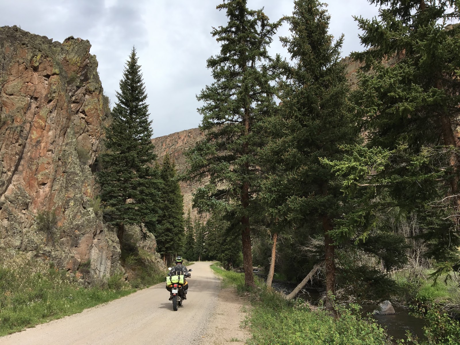

Ahead lay the highest passes of the trip, but first we needed to cross an extraordinary geological feature.


According to the sign at a visitor's pullout:
About 850 years ago, thousands of tons of water-saturated, earthen material broke away from Mesa Seco and slid nearly four miles into the valley below. The Slumgullion Earthflow dammed the Lake Fork of the Gunnison River and formed Lake San Cristobal - the second largest natural lake in Colorado. 
About 350 years ago, another portion of Mesa Seco began to slowly ooze down the hillside. Riding above the older slide, this flow covered about 2.5 miles of the older flow. Geologists estimate that it is still moving downhill approximately twenty feet per year. 
There were many signs of the slide, including large stands of trees tilted at an unnatural downhill angle. A freshly paved highway carved down through the slide, affording some fun cornering after days on slippery dirt.

The frontier town of Lake City made a good brunch stop with free wifi, and there's a good general store with freeze-dried food, nuts, jerky and other ADV essentials. Some interesting old stone buildings in town and again, platoons of ATVs all lining up for day trips over the high passes next on our own agenda. The police were in full action pulling over speeders in ATVs, so it's important to ride carefully here.


Replenished and full of eggs and sausage, we followed the traffic towards Cinnamon Pass. While nowhere near as technical as Tincup Pass, at 12,640' it was one of the highest on our trip and it followed a steep route that required your attention--not least because of all the other trail users and the effects of elevation. The scenery was literally breathtaking, and I could ride this over and over again.


Although it was a struggle for our 250s, we made it over the pass and dropped down into the mining ghost town of Animas Forks at 11,200'. A National Historic site, it's famous today for the remarkable state of preservation of its buildings, which you can walk through. The site receives more than 100,000 visitors per year, and we could believe that given the steady stream of Jeeps and side-by-sides crawling up and down the mountain roads to this location.


Here's what the town looked like circa 1906. Incredibly, there was once a railway to this location:


And today, from a similar vantage point of one of the former mine sites. The road to the right leads up to Engineers Pass, another extraordinary feat of willpower over nature. This pass remains on my bucket list but it's more technical than most and probably requires an OHV permit and more horsepower than my 250 can muster.


The two-story building with the bay window on the right of the above photo is the William Duncan House, built in 1879. Here's a view from inside:


At a home next door was this indoor latrine, below. One winter, the town received 25 feet of snow and residents had to tunnel between buildings. Having indoor "plumbing" would've been a necessity compared to an outhouse. I recall distinctly the outhouses I lived with as a boy in Australia, and certainly wouldn't want to have to trudge out to one in the dead of winter at these elevations.


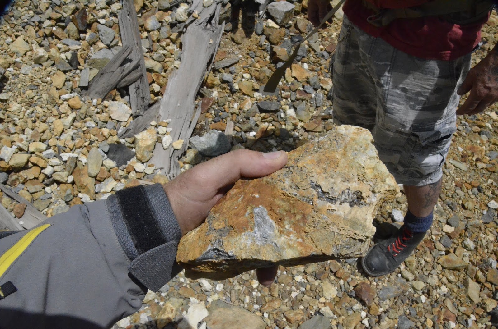
Met a guy rock-picking a tailings pile, and he showed me this excellent sample of silver ore-bearing rock.

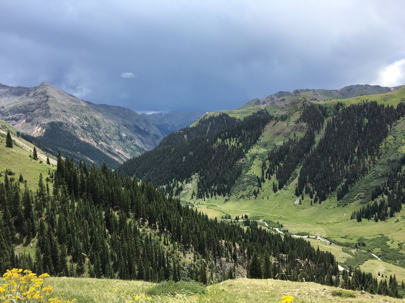
By now the afternoon storms were rumbling in, and we were concerned about getting caught on an exposed ridge where lightning strikes could pose a very real risk. We opted to get down to lower ground quickly, and decide next steps based on what the weather did.


Not far south of Animas Forks is the ghost town of Eureka. While we didn't pass through there on our trip, I recently on a a Reddit thread the following photo from 1900 that's been expertly colorized by Sanna Dullaway. It really helps show the historic appearance of the region.


The same view today, at the same location, can be seen here on Google Street view (photograph by Seth Thomas).

With the storms seeming to head in the opposite direction, we decided to make a sprint for California Pass, the highest of the trip at 12,960'.

Part 11

Saturday, March 30, 2019

Continental Divide ride 2018 - Part 9

Part 8

Air conditioning can make even the crappiest motel room feel like heaven after a long, hard ride.


Rock Springs was a tough, hardscrabble town as we discovered when we'd gone looking for an ATV store for supplies. Our daily post-ride ritual of cleaning and lubing our gritty chains while they were still hot had used a lot of chain lube. Probably overkill in the dusty conditions we faced, but it's cheap insurance against wear or a potential breakdown in the middle of nowhere. I switched to a dry paraffin-based lube which I figured would work better than a wet lube in the heat and dust, and this proved to be a good choice given my negligible chain wear measured after the trip.

With Wyoming's South Pass behind us, and with it the last of the GPSKevin segments we'd intended to follow, we were now well off our planned route. We needed to find a way to get from Rock Springs to the start of the Colorado BDR without taking the Interstate. Some Googling suggested a lonely route southeast back towards the Continental Divide.


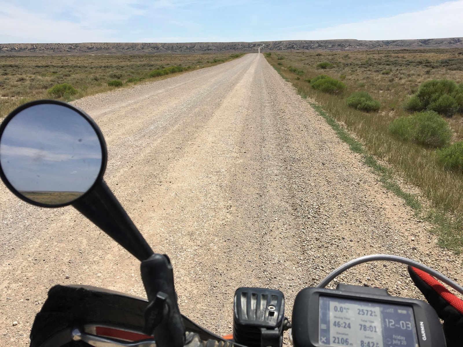
The last few days had impressed upon each of us a new respect for the vast open deserts and distances between outposts in the West. Following the 430 southeast, we were further sobered by a road sign saying no services for the next 120 miles. Thus began an even more desolate stretch of road--although with pristine pavement--that passed what looked like a fertilizer plant outside town before winding its way past prehistoric bluffs of weathered rock.


This was some of the bleakest terrain of the entire trip: just a few vehicles passed us in the next few hours as we wound out our little bikes as fast as they'd go (but still nowhere near the speed limit) and endured blast-furnace air through our helmets, wondering how our engines would cope with the heat. Not a soul to see besides antelope which scattered at our approach and almost matched our speed. The three of us were each lost in our own helmets and thoughts, numbed by the heat, long straights, and monotonous scenery that only barely seemed to indicate forward progress.


Eventually the pavement gave way to wide loose dirt, and we entered active oil and gas country with pump stations, storage tanks, and trailers dotting the horizon at little outposts where the rock had been drilled and pipes laid. Still no people.


After 200km we saw our first tree, a massive old cottonwood that must've found some deep spring, and we stopped in its shade. Probably not the first pilgrims to rest at this very spot.


By now the pavement has resumed and in the distance we could see a hint of mountains. Together these signs lifted our spirits, as they hinted at the start of the Colorado BDR, higher elevations, and cooler temperatures. 

From the desert gradually emerged the Snake River, leading us to the crossroads hamlet of Baggs for gas and food at the Cowboy Inn--the only place to eat. Apparently not a lot of tourists in these parts, and we attracted sidelong looks from the locals. 


Some authentic cowboys chowed down beside us.


Our waitress was nice enough but must've been partly deaf, because she shouted her entire conversation as if the place was hosting a Saturday night whoop-up. Besides us, the cowboys, and a few kids, the joint was practically empty and mostly quiet. It was hard to suppress our laughter in the circumstances. Jeff was not impressed.


After Baggs, we continued to follow the Snake River for a few miles past old homesteads until a right turn took us into the river canyon proper, surrounded by the sudden rise of mountains we'd seen in the distance earlier. This was the start (or end) of the Colorado BDR. The presence of water magically transformed the area from desert to verdant fields of lush grasses, crops, and trees, with horses and other livestock neatly contained by a succession of ranches, the largest being the Three Forks Ranch which encompasses 200,000 acres and caters to the ultra-wealthy. Would be a great place to end a ride on the BDR from the south, assuming you're on BMWs with all the best gear, and not a bunch of greasy dirtbags like we appeared to be! 

All around it was easy riding that nonetheless required all of our attention as the road wound and dipped through the constantly varying terrain. Soon the route left the main dirt road and turned onto a rough track that had been churned while mud and hardened into deep ruts filled with slippery powder and rocks. This route climbed steeply into forest, requiring careful and exhausting bike handling skills to maintain control and momentum while navigating through braided side trails and avoiding the opaque clouds of dust kicked up by riders ahead. No photos of this. It was a short section though, and before long we were on graded rural roads leading down to Steamboat Springs.

Despite the one technical section, our first experience with a BDR seemed a little disappointing. I guess we expected more of an actual backcountry route. However, the 40 miles or so to Steamboat Springs had been better suited to a GS or other large ADV bike biased more to paved roads--the route was really just a suburban cruise past millionaire "cottages" and resorts. 

We naively assumed we'd get a motel in Steamboat, but there was some kind of festival underway and the entire town was a gong show of traffic, crowds, and apparently booked-up rooms. The incongruity of our small bikes loaded with camping gear, and complete filth from head to toe, attracted no small amount of attention (some highly approving) from impeccably dressed fashionistas walking the strip next to BMWs, Mercedes, Range Rovers, and other luxury vehicles. Once again, and feeling like fish out of water, a change of plans was needed. It was getting late and we needed somewhere to stay, and the increasing crowds were discouraging. None of us had expected Colorado to be this busy--it was quite disorienting after being in more rural regions for so long. 

In the end, we decided to head straight to Gypsum a couple of hours away, where we'd planned to meet up with Jeff's in-laws, Greg and Karen. Since it was getting dark, rather than follow the BDR, we took a direct highway route that was mostly deserted of traffic and offered spectacular moonlit views of canyons, peaks, and mountain streams as we carved pavement in the twilight.   

Stopping in Eagle for tacos, salad, and beer at a popular restaurant surrounded by ADV bikes, we discovered a great band which provided rousing live entertainment to an enthusiastic crowd.

Greg and Karen and they were gracious and generous hosts. Greg had retired from his government job in fisheries management, and Karen, an Australian transplant, continued to work as an elementary school teacher like my own wife Karen. Gypsum offered a welcome respite for a couple of days to service the bikes, wash our gear, and sleep peacefully in separate rooms without worrying about bears. This was about the halfway point of our trip. Breaks like this are highly recommended for any long distance travel!


Stillhouse Bourbon was a delicious find. Should've grabbed a couple more cans.


Jeff swapped out the jets on his DR650 to prepare for riding at high elevation.


As we prepared to leave Gypsum recharged and repaired, ominous smoke appeared on the horizon in the direction of our route south. Forest fires were terrible that summer. Having to reroute because of a fire was always on our minds as we monitored fuel and evaluated escape routes.


But clearly, the signage proved this was the way we were meant to go: straight past the Grundel/Valley intersection that had formed the basis of so many jokes about filthy riding clothes. 


Some classic Americana, littered with empty beer cans. When I stopped for this picture, a couple of rough and hungover-looking dudes came out of the house to see what was up. Some devil's horns and a "sweet ride" shouted at them, and we were off.


Immediately the BDR became more interesting and sight for our desert-sore eyes. Red earth, rich with iron minerals, slightly damp and perfectly grippy for our knobbies on the tight turns.


The route climbed to Crooked Pass, and then on to Hagerman Pass, which had just reopened following a fire closure a few days earlier. We got lucky! These were the first of our high pass crossings, which were to be highlights of the entire trip. It was also a taste of some of the technical challenges to come, as we had to goose it up some loose and steep rocky sections.


Wow, 11,925 feet! The US Rockies are much higher than the Canadian Rockies, although they don't seem as high. In British Columbia I've topped out on barren peaks at 10,000' where you feel like you're on top of the world. In Colorado, at that elevation you're still cruising through aspen forest. It's important to be mindful of the elevation, as it can cause acute sickness without much warning, posing significant risks to safety. No crashing allowed!


While we were fine, our bikes certainly struggled with the elevation--the 25-30% power loss on a 250 was quite noticeable and much tap-dancing on the gears was required to make progress.

The descent to Leadville wound through more tight forest dual-track before hitting pavement again. Leadville is the highest incorporated city in the United States and the site of massive mining operations during the heydays of the wild west. Rich evidence of the mining heritage and wealth it created lay all around us, but we didn't have time to explore. Lots of tourists.


Although this was my first time in Leadville, I was somewhat surprised and overwhelmed by how it triggered some old memories of a friend from university days who'd worked here one summer after graduation. Always wondered what happened to her. It was with mixed feelings that I rode away after such a short visit, and I couldn't shake the memories for many days after.

For the first time in weeks we encountered the threat of a serious afternoon storms brewing on the peaks, as is typical in this area. Dark clouds swept towards the route ahead of us, punctuated by violent flashes of lighting. We were riding dirt that was becoming increasingly slick as it started to absorb drops blown our way. Many signs of recent forest fires, including ones that closed our intended route over Weston Pass and further on.


With a growing threat of torrential downpours and lightning, we had no choice but to re-route to lower elevation and hit the highway to see if we could skirt the storm. By now the wind was violent, and riding on the highway pelted us with massive rain drops that felt like bullets even through our armour. Miraculously, the cars were polite and we managed to evade the worst of the assault.

The town of Buena Vista--pronounced "Byoona Vis-ta" by the abundant athletic and highly attractive mountain-biking and coffee-sipping locals--was our gateway to the highest passes of the Rockies that we'd be crossing over the next few days. Although well worth the stop, we were initially discouraged by the availability of camping and the high price of rooms in town. Dog-tired from exertion at high elevation but not wanting to spend a lot of money to sleep on the floor (it was my turn again), we walked out of one hotel because of the price, only to have the concierge chase after us and offer a significant discount. Deal! Always pays to negotiate.


The restaurant and outdoor gear available at this combo store was excellent.


Hard to argue with a delicious local microbrew coconut stout washing down bison-stuffed ravioli in a sage butter sauce. 


A volunteer trail ranger stopped at our hotel and we had a good chat about trail passes for the backcountry. Since the BDR follows designated county roads (although some are barely rough tracks), we didn't need state passes to travel those roads, but many of the side-routes are designated as OHV (Off-Highway Vehicle) routes and do require state OHV passes. No exceptions for out-of-state users. Good to know for next time, or if we wanted to deviate from the BDR to see some of the other high passes. It was hard to get clear information on the requirements and how to obtain the passes--not something that is easy to foresee or access for foreigners like us.

And there were the big peaks. We'd planned to cross via Cottonwood Pass as indicated on the BDR, but it was closed for the year to undergo major roadwork. Our alternate route was Tincup Pass a bit further south, which reconnected with the BDR. It's a much more rugged route and would be a struggle for all but the most skilled big-bike ADV riders. Even for us on smaller bikes it proved to be a technical challenge--especially for Jeff and Peter, who were less experienced than me on rough terrain and understandably more nervous about getting through.