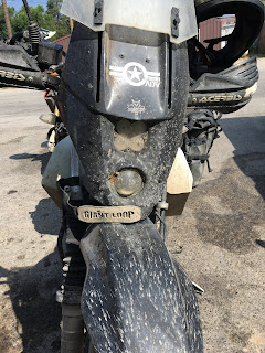
Our arrival into Ellis on the Yankee Fork trail turned out to be the last dirt section of our journey. By now we'd been on the road for over a month, living in close quarters and sharing helmet space with each other for almost the entire time. I'd finally run out of dad jokes and bad puns (much to Pete and Jeff's relief) and in the heat and smoke of what would be a record summer for forest fires, we all felt as grimy and in need of some TLC as Jeff's bike.
Even though we were now slabbing our way back north on Interstate 93, there were still some interesting things to see along the way. To our west lay the Selway-Bitterroot Wilderness that we had intended to traverse on the Idaho BDR. As we passed through its eastern foothills, our 250s struggled to keep ahead of traffic in the passes. But our effort was nothing compared to the incongruous struggles of a lone unicyclist outfitted with touring bags we spotted coming jerkily in the other direction. I guess the advantage of having just one wheel is a 50% lower chance of getting a flat tire. Since I wasn't able to stop, I didn't get the name of the rider. A web search improbably showed several possibilities for unicyclists crossing the country on a large green wheel. I thought it could be Ed Pratt from the UK, but when I emailed him he said he was safely back home after riding around the world. So, somewhere out there was at least one other green-wheeled unicyclist tackling mountains one crotch-rending, janky pedal stroke at a time.
Just south of Missoula, MT is the town of Lolo with the fantastic Lolo Peak brew pub that's well worth a stop. The tacos and beer were delicious, and that's not just the day's hunger speaking.
Continuing north, we battled hours of gusty cross-winds on the Interstate, made worse by passing semi-trailers and our loaded small bikes. A reminder of our mortality came in the form of a nasty car crash we passed, that had apparently just happened. Frequent stops at unremarkable truck stops were needed to rest our forearms, which burned from the effort of staying on track and upright. One such stop had this beauty:
Our route again lead towards Kalispell, MT, intersecting our outbound path from a month earlier where we'd bought a SIM card for Jeff's phone. Just before Kalispell was Flathead Lake, which gave us an unexpected stunning vista across the water with golden, late afternoon light and great pavement. This side of the lake was studded with orchards and nifty cottages and lakefront properties. Not at all what I'd expected to find in the area, but proof of what's possible when fresh water abounds. Our search for a particular campground was a bust, as there were no vacancies and so we had to push on to find a motel in Kalispell. This was a familiar ritual for us, usually done late in the afternoon. It's always tough to balance the desire to make miles, with the need to stop early enough to get a place for the night. It's one of the reasons why I love traveling in the back-country, because you can stop pretty much anywhere and find a campsite all to yourself.
Our only option for the night was an exceedingly grimy motel where every room was apparently fumigated by decades of stale cigarette smoke. Outside, a large horde of loud, drunk, and aggressively unfriendly Harley riders on their way to Sturgis had convened for the night, as well as a few other ADV riders on big bikes. It was a strangely tense atmosphere. The Harley dudes threw some shade our way, adding to our own tension from fatigue and hunger. That night it was Pete's turn to sleep on the floor, and he accepted his duty like a champ, all cozied up to our smelly riding gear.
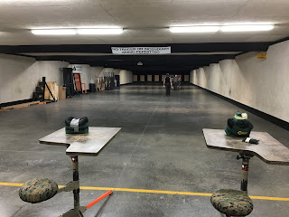
Of course, being in the USA we were surrounded by guns. Jeff had the brilliant idea of visiting a nearby shooting range where we could try weapons that are prohibited back in Canada. While we waited for the range to open, a young mom and her kids arrived to shoot, as well as an old guy in an expensive Audi. A couple hundred bucks later, we were outfitted with 500 rounds of 9mm ammunition, two pistols, and an MP5 machine gun. Since I'd only ever shot rifles before, this was a real thrill! Jeff, a competitive pistol and rifle shooter, instructed us while a humorless and jacked range officer looked on with a pistol on his own hip, and then we let loose.
For a first-timer, my pistol groupings were pretty good, but anyone standing in front of my MP5 would've probably been safe. Between my unsuitable eyeglasses and the poor downrange lighting, I couldn't really see where I was hitting, even in single-shot mode. In full auto, I was surprised by how much muzzle climb there was--it takes an aggressive stance and a lot of control to aim. For the first time I could truly understand how an inexperienced shooter could completely miss their target, even in full-spray mode. Challenge accepted though: three-gun competition would be a lot of fun to train for.
Since we still had our national park passes, we wanted to head back to Canada through Glacier National Park via Going-to-the-Sun Road. On our trip down, we'd been unable to take that route because it would've meant backtracking right at the start. It proved to be an amazing ride, and should be on everyone's bucket list--as it evidently was, judging by the traffic.
Carved into the steep side of a glacial valley, the road is steep and narrow with small pull-outs. While there was a good amount of traffic when we rode through, during a peak weekend day it would've been frustrating to maintain any kind of pace on a motorbike. Parking was hard to find for cars, but no problem for our motorcycles which could sneak into designated spots.
The steep landscape gives the impression that the mountains are much higher than they actually are. For instance, Reynolds Mountain, one of the prominent peaks, tops out at 2781 metres. For comparison, much of our journey along the Continental Divide was above 2000 metres and up to almost 4,000 meters on some of the Colorado passes. No wonder our little bikes (and ourselves) suffered for power up there!
Side trails hinted at some interesting day hikes, but suited in our riding gear and pressed for time, we'd have to explore them on another trip.
Sadly, Glacier National Park will soon be a misnomer due to global warming. Measurements predict that all the glaciers will melt away within the next 50-100 years. Photos of the park taken over the last 100 years clearly show how rapidly the ice has receded.
Descending from the sky and continuing north, we passed by Saint Mary Lake, which on a sunny day offers spectacular photo opportunities.
Soon the road flattened out, and all of a sudden we noticed that the mountains had slipped away behind us along with the crowds of tourists. Bison grazed in the distance.
Once again, it was just the three of us on a deserted highway. The Canadian border lay ahead. As if to welcome us back home after a month of parching heat, the skies turned black and ominous. No shelter from lightning out here, and we became concerned for our safety.
As we were passing through First Nations lands, there were no options for camping and so we aimed for the small town of Cardston. At our motel, we were struck by all the different nationalities and languages we heard among the other guests. Other than in Moab, we'd seen almost no visible minorities on our entire trip in the US. It's not remarkable until you're suddenly presented with the obvious differences.
Cardston is notable for being one of the most northerly Mormon communities that arose when the daughter of Brigham Young (the founder of Salt Lake City and Mormon religious leader) headed up from Utah in 1887 to find new lands to settle. Intended originally as a temporary stopping point for the winter, the Mormons ended up staying and eventually building a town, much to the displeasure of the Blood Tribe First Nation, who already inhabited the area. Thus began a long dispute until the present day over rights to the lands, which had been recognized as Blood Tribe territory under a landmark treaty with the Canadian government. It's a complex issue with no easy answers. Nevertheless, after decades of litigation, the Blood Tribe finally won its land claim in 2019 - a major milestone in our shared First Nations and Canadian history. Hopefully this win helps the local First Nations achieve some prosperity after more than a century of challenges and oppression under the federal and provincial governments.
A must-see stop in Cardston is the Remington Carriage Museum. Admittedly, the three of us were initially skeptical of what we'd find there, but this is undoubtedly a world-class attraction for history buffs. As the name suggests, the museum hosts an extraordinary collection of restored carriages dating back to the earliest days of the wild west. The displays and explanations are engrossing: they really bring to life the challenges that European settlers faced as they traversed the continent. You could smell the adventure. We had the place to ourselves and enjoyed an inexpensive breakfast of bacon and eggs in the on-site cafeteria.
The museum also has a restoration workshop where original tools and methods are used to repair and build carriages.
This was one of the original stagecoaches that plied a route through Helena, MT where we'd ridden.
And tucked away was this marvel of history: the original frame of the covered wagon that Brigham Young's daughter drove north from Utah to settle what would become Cardston, the first Mormon town in Canada.
The Coen Brothers movie The Ballad of Buster Scruggs gives an entertaining look at the wild west era. The production incorporated meticulous reproductions of the clothing and other artifacts of the time, and was filmed in several of the locations we rode through on our journey.
Now we could smell home, although a more rain stood in our way.
The skies soon cleared by the time we reached High River, where there's an original frontier fort situated at the end of the Redcoat Trail running from Fort Garry in Manitoba. Once again we were plunged into heat for the remainder of our trip.
Colossi's Cafe, also in High River had the best coffee of the entire trip, and it certainly ranks among my top-10 of all-time. It wasn't just the mood and end of trip euphoria that made it taste so good; this was damn good coffee! It was also the only place we could find open in the entire town.
Finally we rolled into Calgary, ending our journey where we'd started 5 weeks earlier.
Pete and I spent a day wandering around and eating while Jeff made a mad run east to visit the dinosaur museum at Drumheller. I'd hoped to visit this as well, but taking a break from riding felt great and I needed the mental break to prepare for my return to work, family, and responsibilities.
After steak and dessert and beer, we packed up our bikes with the shippers and flew home.
Final thoughts
When we started out on this trip, I thought it would be ample time to scratch my itch for a long adventure, and that by the end I'd be more or less sick of riding. But arriving back in Calgary, I realized the opposite: more than anything, the trip kindled a deep desire to just keep going. I really didn't want to go home, or back to routine, or back to the complexities of professional life. Living on a 250, eating when hungry, resting when tired, and following a natural schedule driven by sunlight proved to be incredibly stimulating and healthy. 15 pounds had melted away in just over a month, and all that standing on the pegs in riding gear and at altitude also proved to be good cross-training for cycling. (Afterwards, pedaling 120km felt like a breeze!)
The mental journey was life-changing for me as well. As I write now, 16 months after the trip ended, not a day has gone when I don't think about the riding and scenery, the camaraderie of Pete and Jeff, the people we met along the way, the heat and dust, and the pure thrill of just going. Pete, Jeff and I have continued to ride together, and we regularly discuss new adventures and share thoughts on gear, bikes, and life in general. Pretty good outcome considering the various stresses and challenges we endured on the trip, and the fact that we'd only just met earlier that year via my ADVRider posting looking for trip buddies.
So, where next? Despite its large urban areas, the vast majority of North America consists of unpopulated wilderness that varies from mountains to forests, deserts, tundra, lakes, and ocean. Since it's got a bit of everything and it's a fantastic place to explore by motorbike, I do find it irresistible. Much of the built environment--particularly in the west--only dates back to the mid-1800s. Arid conditions have preserved many remnants of this past. It's as if the emigrants on the Oregon Trail had only temporarily left these artifacts within my own lifetime--the history is so palpable and relatable. At the same time, the forlorn and remote outposts of those migrating Americans amplify the sense of isolation and wilderness. It's a truly rugged area to travel in alone; a lot can go wrong quickly and far from help. The people we met were moulded by this environment and gave a sense of being highly independent. While friendly and polite, they also seemed mildly suspicious of outsiders.
We noticed how little news of the world outside the USA seemed to penetrate the hermetic bubble we traveled through. Many Canadians believe the US has a similar culture (and it's hard not to, given all the US media Canadians consume!). However, I was surprised by the culture shock I felt on my return. Calgary was a riot of different races, colours, languages, and foods that we hadn't seen in over a month. So, traveling in the US really does feel to me like traveling in a foreign country. It certainly poses many unknowns.
When planning this trip, I admit to having some trepidations about our personal security given the politics of the day and the seemingly endless reports of shootings and police acting with impunity. Fortunately we didn't encounter any of these problems. Other the few gun-carrying Nazis we met in Butte, the vast majority of people seemed nice enough--as was the case in the 30+ other countries I've visited. We did sometimes attract strange looks for riding our small Japanese bikes in places where heavy cruisers rule. Despite what the magazines and forums suggest, ADV riding is still very much a niche pursuit. In fact, we met only a handful of other cross-country ADV riders during our entire trip--and that's on one of the more popular routes.
I'd like to ride the route again, next time pushing farther west along the TAT, heading up into the Pacific Northwest, and back to the Bitterroot. Not sure when or even if that may happen. But in the meantime, thanks to all the wonderful people who helped us along the way. I hope to visit more of your country soon!
Here's Part 1 if you want to read the whole series.


