Air conditioning can make even the crappiest motel room feel like heaven after a long, hard ride.

Rock Springs was a tough, hardscrabble town as we discovered when we'd gone looking for an ATV store for supplies. Our daily post-ride ritual of cleaning and lubing our gritty chains while they were still hot had used a lot of chain lube. Probably overkill in the dusty conditions we faced, but it's cheap insurance against wear or a potential breakdown in the middle of nowhere. I switched to a dry paraffin-based lube which I figured would work better than a wet lube in the heat and dust, and this proved to be a good choice given my negligible chain wear measured after the trip.
With Wyoming's South Pass behind us, and with it the last of the GPSKevin segments we'd intended to follow, we were now well off our planned route. We needed to find a way to get from Rock Springs to the start of the Colorado BDR without taking the Interstate. Some Googling suggested a lonely route southeast back towards the Continental Divide.

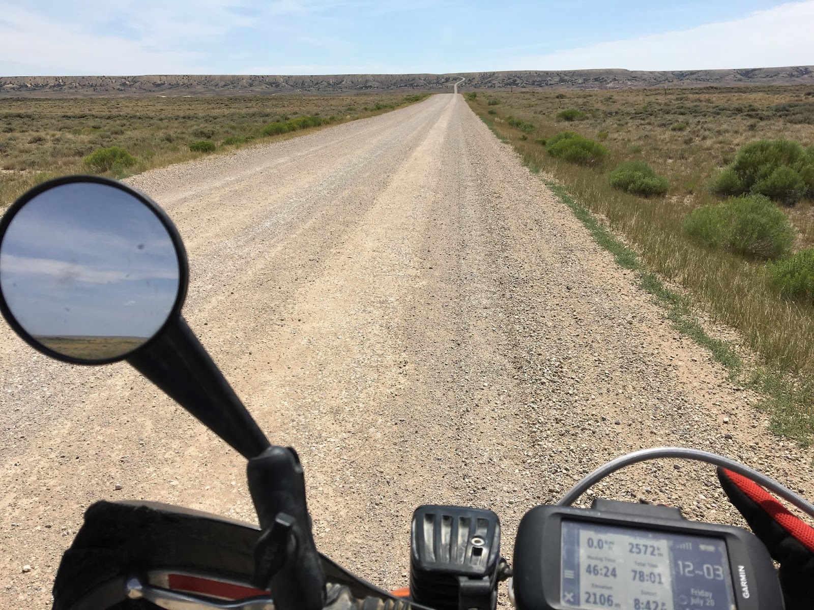
The last few days had impressed upon each of us a new respect for the vast open deserts and distances between outposts in the West. Following the 430 southeast, we were further sobered by a road sign saying no services for the next 120 miles. Thus began an even more desolate stretch of road--although with pristine pavement--that passed what looked like a fertilizer plant outside town before winding its way past prehistoric bluffs of weathered rock.

This was some of the bleakest terrain of the entire trip: just a few vehicles passed us in the next few hours as we wound out our little bikes as fast as they'd go (but still nowhere near the speed limit) and endured blast-furnace air through our helmets, wondering how our engines would cope with the heat. Not a soul to see besides antelope which scattered at our approach and almost matched our speed. The three of us were each lost in our own helmets and thoughts, numbed by the heat, long straights, and monotonous scenery that only barely seemed to indicate forward progress.

Eventually the pavement gave way to wide loose dirt, and we entered active oil and gas country with pump stations, storage tanks, and trailers dotting the horizon at little outposts where the rock had been drilled and pipes laid. Still no people.
After 200km we saw our first tree, a massive old cottonwood that must've found some deep spring, and we stopped in its shade. Probably not the first pilgrims to rest at this very spot.

By now the pavement has resumed and in the distance we could see a hint of mountains. Together these signs lifted our spirits, as they hinted at the start of the Colorado BDR, higher elevations, and cooler temperatures.
From the desert gradually emerged the Snake River, leading us to the crossroads hamlet of Baggs for gas and food at the Cowboy Inn--the only place to eat. Apparently not a lot of tourists in these parts, and we attracted sidelong looks from the locals.

Some authentic cowboys chowed down beside us.

Our waitress was nice enough but must've been partly deaf, because she shouted her entire conversation as if the place was hosting a Saturday night whoop-up. Besides us, the cowboys, and a few kids, the joint was practically empty and mostly quiet. It was hard to suppress our laughter in the circumstances. Jeff was not impressed.

After Baggs, we continued to follow the Snake River for a few miles past old homesteads until a right turn took us into the river canyon proper, surrounded by the sudden rise of mountains we'd seen in the distance earlier. This was the start (or end) of the Colorado BDR. The presence of water magically transformed the area from desert to verdant fields of lush grasses, crops, and trees, with horses and other livestock neatly contained by a succession of ranches, the largest being the Three Forks Ranch which encompasses 200,000 acres and caters to the ultra-wealthy. Would be a great place to end a ride on the BDR from the south, assuming you're on BMWs with all the best gear, and not a bunch of greasy dirtbags like we appeared to be!
All around it was easy riding that nonetheless required all of our attention as the road wound and dipped through the constantly varying terrain. Soon the route left the main dirt road and turned onto a rough track that had been churned while mud and hardened into deep ruts filled with slippery powder and rocks. This route climbed steeply into forest, requiring careful and exhausting bike handling skills to maintain control and momentum while navigating through braided side trails and avoiding the opaque clouds of dust kicked up by riders ahead. No photos of this. It was a short section though, and before long we were on graded rural roads leading down to Steamboat Springs.
Despite the one technical section, our first experience with a BDR seemed a little disappointing. I guess we expected more of an actual backcountry route. However, the 40 miles or so to Steamboat Springs had been better suited to a GS or other large ADV bike biased more to paved roads--the route was really just a suburban cruise past millionaire "cottages" and resorts.
We naively assumed we'd get a motel in Steamboat, but there was some kind of festival underway and the entire town was a gong show of traffic, crowds, and apparently booked-up rooms. The incongruity of our small bikes loaded with camping gear, and complete filth from head to toe, attracted no small amount of attention (some highly approving) from impeccably dressed fashionistas walking the strip next to BMWs, Mercedes, Range Rovers, and other luxury vehicles. Once again, and feeling like fish out of water, a change of plans was needed. It was getting late and we needed somewhere to stay, and the increasing crowds were discouraging. None of us had expected Colorado to be this busy--it was quite disorienting after being in more rural regions for so long.
In the end, we decided to head straight to Gypsum a couple of hours away, where we'd planned to meet up with Jeff's in-laws, Greg and Karen. Since it was getting dark, rather than follow the BDR, we took a direct highway route that was mostly deserted of traffic and offered spectacular moonlit views of canyons, peaks, and mountain streams as we carved pavement in the twilight.
Stopping in Eagle for tacos, salad, and beer at a popular restaurant surrounded by ADV bikes, we discovered a great band which provided rousing live entertainment to an enthusiastic crowd.

Greg and Karen and they were gracious and generous hosts. Greg had retired from his government job in fisheries management, and Karen, an Australian transplant, continued to work as an elementary school teacher like my own wife Karen. Gypsum offered a welcome respite for a couple of days to service the bikes, wash our gear, and sleep peacefully in separate rooms without worrying about bears. This was about the halfway point of our trip. Breaks like this are highly recommended for any long distance travel!


Stillhouse Bourbon was a delicious find. Should've grabbed a couple more cans.


As we prepared to leave Gypsum recharged and repaired, ominous smoke appeared on the horizon in the direction of our route south. Forest fires were terrible that summer. Having to reroute because of a fire was always on our minds as we monitored fuel and evaluated escape routes.

But clearly, the signage proved this was the way we were meant to go: straight past the Grundel/Valley intersection that had formed the basis of so many jokes about filthy riding clothes.

Some classic Americana, littered with empty beer cans. When I stopped for this picture, a couple of rough and hungover-looking dudes came out of the house to see what was up. Some devil's horns and a "sweet ride" shouted at them, and we were off.


The route climbed to Crooked Pass, and then on to Hagerman Pass, which had just reopened following a fire closure a few days earlier. We got lucky! These were the first of our high pass crossings, which were to be highlights of the entire trip. It was also a taste of some of the technical challenges to come, as we had to goose it up some loose and steep rocky sections.


Wow, 11,925 feet! The US Rockies are much higher than the Canadian Rockies, although they don't seem as high. In British Columbia I've topped out on barren peaks at 10,000' where you feel like you're on top of the world. In Colorado, at that elevation you're still cruising through aspen forest. It's important to be mindful of the elevation, as it can cause acute sickness without much warning, posing significant risks to safety. No crashing allowed!

While we were fine, our bikes certainly struggled with the elevation--the 25-30% power loss on a 250 was quite noticeable and much tap-dancing on the gears was required to make progress.
The descent to Leadville wound through more tight forest dual-track before hitting pavement again. Leadville is the highest incorporated city in the United States and the site of massive mining operations during the heydays of the wild west. Rich evidence of the mining heritage and wealth it created lay all around us, but we didn't have time to explore. Lots of tourists.

Although this was my first time in Leadville, I was somewhat surprised and overwhelmed by how it triggered some old memories of a friend from university days who'd worked here one summer after graduation. Always wondered what happened to her. It was with mixed feelings that I rode away after such a short visit, and I couldn't shake the memories for many days after.
For the first time in weeks we encountered the threat of a serious afternoon storms brewing on the peaks, as is typical in this area. Dark clouds swept towards the route ahead of us, punctuated by violent flashes of lighting. We were riding dirt that was becoming increasingly slick as it started to absorb drops blown our way. Many signs of recent forest fires, including ones that closed our intended route over Weston Pass and further on.

With a growing threat of torrential downpours and lightning, we had no choice but to re-route to lower elevation and hit the highway to see if we could skirt the storm. By now the wind was violent, and riding on the highway pelted us with massive rain drops that felt like bullets even through our armour. Miraculously, the cars were polite and we managed to evade the worst of the assault.
The town of Buena Vista--pronounced "Byoona Vis-ta" by the abundant athletic and highly attractive mountain-biking and coffee-sipping locals--was our gateway to the highest passes of the Rockies that we'd be crossing over the next few days. Although well worth the stop, we were initially discouraged by the availability of camping and the high price of rooms in town. Dog-tired from exertion at high elevation but not wanting to spend a lot of money to sleep on the floor (it was my turn again), we walked out of one hotel because of the price, only to have the concierge chase after us and offer a significant discount. Deal! Always pays to negotiate.


The restaurant and outdoor gear available at this combo store was excellent.

Hard to argue with a delicious local microbrew coconut stout washing down bison-stuffed ravioli in a sage butter sauce.

And there were the big peaks. We'd planned to cross via Cottonwood Pass as indicated on the BDR, but it was closed for the year to undergo major roadwork. Our alternate route was Tincup Pass a bit further south, which reconnected with the BDR. It's a much more rugged route and would be a struggle for all but the most skilled big-bike ADV riders. Even for us on smaller bikes it proved to be a technical challenge--especially for Jeff and Peter, who were less experienced than me on rough terrain and understandably more nervous about getting through.

Good take on this section of our adventure. I laughed out loud at "(some highly approving)".
ReplyDelete